
File:Thatched Cottage and Maypole - geograph.org.uk - 314401.jpg
No higher resolution available.
Thatched_Cottage_and_Maypole_-_geograph.org.uk_-_314401.jpg (640 × 480 pixels, file size: 124 KB, MIME type: image/jpeg)
| This is a file from the Wikimedia Commons. Information from its description page there is shown below. Commons is a freely licensed media file repository. You can help. |
Summary
| Description |
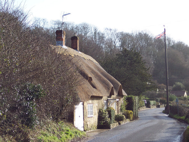
English: Thatched Cottage and Maypole Ansty is a very picturesque village with a large pond surrounded by the Manor House, cottages and ancient Commandery.
It has been the scene of May Day gatherings for over 1,000 years. The Maypole itself was a gift from the Arundells of Wardour Castle and replaced every twenty years - the present one is keeping with earlier tradition, still has a silver coin lodged beneath the weather vane. It is said that whoever is brave enough or foolhardy enough to climb the pole can keep it. Originally, tenants of the Wardour estate brought their children to meet each other and dance around the maypole every year. This gathering has continued annually for hundreds of years, except during 1644 to 1660 when Puritan officials removed the pole by government statute. |
| Date | |
| Source | From geograph.org.uk |
| Author | Trish Steel |
| Camera location | | View this and other nearby images on: OpenStreetMap |
|---|
_heading:135.00&language=en)
| Object location | | View this and other nearby images on: OpenStreetMap |
|---|
_heading:135.00&language=en)
Licensing

|
This image was taken from the Geograph project collection. See this photograph's page on the Geograph website for the photographer's contact details. The copyright on this image is owned by Trish Steel and is licensed for reuse under the Creative Commons Attribution-ShareAlike 2.0 license.
|
This file is licensed under the Creative Commons Attribution-Share Alike 2.0 Generic license.
Attribution: Trish Steel
- You are free:
- to share – to copy, distribute and transmit the work
- to remix – to adapt the work
- Under the following conditions:
- attribution – You must give appropriate credit, provide a link to the license, and indicate if changes were made. You may do so in any reasonable manner, but not in any way that suggests the licensor endorses you or your use.
- share alike – If you remix, transform, or build upon the material, you must distribute your contributions under the same or compatible license as the original.
File history
Click on a date/time to view the file as it appeared at that time.
| Date/Time | Thumbnail | Dimensions | User | Comment | |
|---|---|---|---|---|---|
| current | 15:53, 30 December 2010 | | 640 × 480 (124 KB) | GeographBot | == {{int:filedesc}} == {{Information |description={{en|1=Thatched Cottage and Maypole Ansty is a very picturesque village with a large pond surrounded by the Manor House, cottages and ancient Commandery. It has been the scene of May Day gatherings for |
File usage
The following pages on the English Wikipedia use this file (pages on other projects are not listed):
Global file usage
The following other wikis use this file:
- Usage on ceb.wikipedia.org
- Usage on fr.wikipedia.org
- Usage on lld.wikipedia.org
- Usage on pl.wikipedia.org
- Usage on www.wikidata.org
- Usage on zh-min-nan.wikipedia.org