
File:The Ord - geograph.org.uk - 149356.jpg
No higher resolution available.
The_Ord_-_geograph.org.uk_-_149356.jpg (640 × 480 pixels, file size: 284 KB, MIME type: image/jpeg)
| This is a file from the Wikimedia Commons. Information from its description page there is shown below. Commons is a freely licensed media file repository. You can help. |
Summary
| Description |
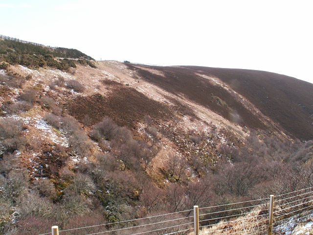
English: The Ord. Although much of the area from Helmsdale to Berriedale is called the Ord this is the Ord proper. The A9 from Edinburgh, and the main one into Caithness rises from sea level to little more than 220 mts AMSL but it's exposed and can be very tricky to impassable in poor winter weather. This the Sutherland Caithness border from the Sutherland side. |
| Date | |
| Source | From geograph.org.uk |
| Author | Jim Bain |
| Attribution (required by the license) | Jim Bain / The Ord / |
| Camera location | | View this and other nearby images on: OpenStreetMap |
|---|
_heading:112.00&language=en)
| Object location | | View this and other nearby images on: OpenStreetMap |
|---|
_heading:112.00&language=en)
Licensing

|
This image was taken from the Geograph project collection. See this photograph's page on the Geograph website for the photographer's contact details. The copyright on this image is owned by Jim Bain and is licensed for reuse under the Creative Commons Attribution-ShareAlike 2.0 license.
|
This file is licensed under the Creative Commons Attribution-Share Alike 2.0 Generic license.
Attribution: Jim Bain
- You are free:
- to share – to copy, distribute and transmit the work
- to remix – to adapt the work
- Under the following conditions:
- attribution – You must give appropriate credit, provide a link to the license, and indicate if changes were made. You may do so in any reasonable manner, but not in any way that suggests the licensor endorses you or your use.
- share alike – If you remix, transform, or build upon the material, you must distribute your contributions under the same or compatible license as the original.
File history
Click on a date/time to view the file as it appeared at that time.
| Date/Time | Thumbnail | Dimensions | User | Comment | |
|---|---|---|---|---|---|
| current | 10:16, 31 January 2010 | | 640 × 480 (284 KB) | GeographBot | == {{int:filedesc}} == {{Information |description={{en|1=The Ord. Although much of the area from Helmsdale to Berridale is called the Ord this is the Ord propper. The A9 from Edinburgh, and the main one into Caithness rises from sea level to little more t |
File usage
The following page uses this file:
Global file usage
The following other wikis use this file:
- Usage on ceb.wikipedia.org
- Usage on www.wikidata.org