
File:Triagoz plan 1871.jpg
Size of this preview: 515 × 600 pixels. Other resolutions: 206 × 240 pixels | 412 × 480 pixels | 660 × 768 pixels | 1,108 × 1,290 pixels.
Original file (1,108 × 1,290 pixels, file size: 865 KB, MIME type: image/jpeg)
| This is a file from the Wikimedia Commons. Information from its description page there is shown below. Commons is a freely licensed media file repository. You can help. |
Summary
| Description |
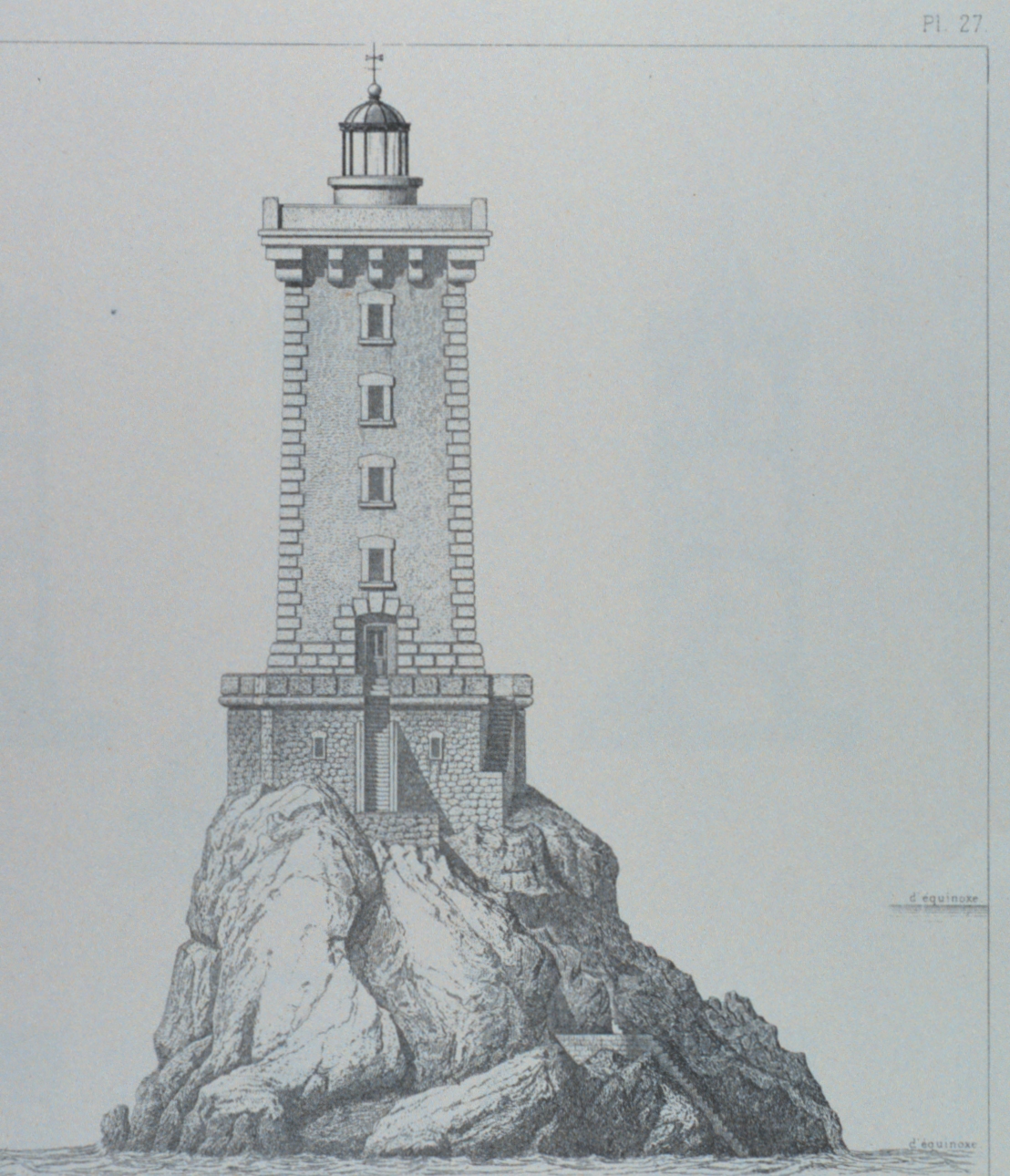
English: The Lighthouse at Triagoz. Plate 27, Figure 1. Shows high and low water. In: 'Memoir upon the Lighting, Beaconage, and Buoyage of the Coast of France" by M. Leonce Reynaud. Plates. Translated by Rear Admiral Thornton A. Jenkins, U. S. N. 1871. Washington.
NOAA Call Number TC 375 .R45 1871. Image ID: libr0203, Treasures of the NOAA Library Collection Photographer: Archival Photograph by Mr. Sean Linehan, NOS, NGS |
| Date | |
| Source | NOAA |
| Author | M. Leonce Reynaud |
| Object location | | View this and other nearby images on: OpenStreetMap |
|---|
Licensing
|
This work is in the public domain in its country of origin and other countries and areas where the copyright term is the author's life plus 70 years or fewer. | |
| This file has been identified as being free of known restrictions under copyright law, including all related and neighboring rights. | |
File history
Click on a date/time to view the file as it appeared at that time.
| Date/Time | Thumbnail | Dimensions | User | Comment | |
|---|---|---|---|---|---|
| current | 20:07, 28 July 2008 | | 1,108 × 1,290 (865 KB) | Julien Carnot | {{Information |Description={{en|1=The Lighthouse at Triagoz. Plate 27, Figure 1. Shows high and low water. In: 'Memoir upon the Lighting, Beaconage, and Buoyage of the Coast of France" by M. Leonce Reynaud. Plates. Translated by Rear Admiral Thornton A. J |
File usage
The following pages on the English Wikipedia use this file (pages on other projects are not listed):
Global file usage
The following other wikis use this file:
- Usage on de.wikipedia.org
- Usage on fr.wikipedia.org