
File:Wartheland.png

Size of this preview: 569 × 599 pixels. Other resolutions: 228 × 240 pixels | 456 × 480 pixels | 729 × 768 pixels | 972 × 1,024 pixels | 1,682 × 1,772 pixels.
Original file (1,682 × 1,772 pixels, file size: 889 KB, MIME type: image/png)
| This is a file from the Wikimedia Commons. Information from its description page there is shown below. Commons is a freely licensed media file repository. You can help. |
Summary
| Description |
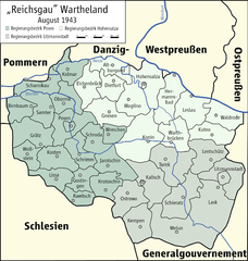
English: Map of "Reichsgau Wartheland", 1943
Deutsch: Karte des "Reichsgaus Wartheland", 1943 |
| Date | |
| Source | Own work |
| Author | Kgberger |

|
This map has been made or improved in the German Kartenwerkstatt (Map Lab). You can propose maps to improve as well.
|
Licensing
| I, the copyright holder of this work, release this work into the public domain. This applies worldwide. In some countries this may not be legally possible; if so: I grant anyone the right to use this work for any purpose, without any conditions, unless such conditions are required by law. |
File history
Click on a date/time to view the file as it appeared at that time.
| Date/Time | Thumbnail | Dimensions | User | Comment | |
|---|---|---|---|---|---|
| current | 17:23, 27 January 2009 | | 1,682 × 1,772 (889 KB) | Ziegelbrenner | {{Information |Description= |Source= |Date= |Author= |Permission= |other_versions= }} |
| 14:43, 26 January 2009 |  | 1,772 × 1,772 (904 KB) | Ziegelbrenner | {{Information |Description={{en|1=Map of "Reichsgau Wartheland", 1943}} {{de|1=Karte des "Reichsgaus Wartheland", 1943}} |Source=Eigenes Werk (own work) |Author=Kgberger |Date=2009-01-26 |Permission= |other_versions=unknown }} <!--{{Ima |
File usage
No pages on the English Wikipedia use this file (pages on other projects are not listed).
Global file usage
The following other wikis use this file:
- Usage on ca.wikipedia.org
- Usage on de.wikipedia.org
- Landkreis Lentschütz
- Landkreis Kalisch
- Landkreis Konin
- Landkreis Hermannsbad
- Landkreis Warthbrücken
- Kreis Schrimm
- Kreis Schroda
- Kreis Wreschen
- Landkreis Birnbaum (Wartheland)
- Landkreis Samter
- Kreis Rawitsch
- Kreis Posen
- Kreis Obornik
- Landkreis Lissa (Wartheland)
- Landkreis Scharnikau (Wartheland)
- Kreis Krotoschin
- Landkreis Grätz (Wartheland)
- Kreis Jarotschin
- Landkreis Kosten (Wartheland)
- Landkreis Ostrowo
- Landkreis Altburgund
- Landkreis Dietfurt (Wartheland)
- Landkreis Eichenbrück
- Landkreis Gnesen
- Landkreis Hohensalza
- Landkreis Mogilno
- Landkreis Kutno
- Landkreis Waldrode
- Landkreis Leslau
- Landkreis Welun
- Landkreis Lask
- Landkreis Schieratz
- Landkreis Turek
- Landkreis Litzmannstadt
- Landkreis Wollstein
- Kreis Kolmar i. Posen
- Landkreis Gostingen
- Wikipedia:Kartenwerkstatt/Archiv/2009-01
- Regierungsbezirk Hohensalza
- Regierungsbezirk Litzmannstadt
- Regierungsbezirk Posen (Wartheland)
- Oberlandesgericht Posen
- Benutzer:Ziegelbrenner/Meine Bilder auf Commons
- Kreis Kempen (Wartheland)
- Usage on fr.wikipedia.org
View more global usage of this file.