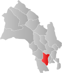
File:Øvre Eiker kart.png
Appearance

Size of this preview: 535 × 600 pixels. Other resolutions: 214 × 240 pixels | 428 × 480 pixels | 700 × 785 pixels.
Original file (700 × 785 pixels, file size: 21 KB, MIME type: image/png)
File history
Click on a date/time to view the file as it appeared at that time.
| Date/Time | Thumbnail | Dimensions | User | Comment | |
|---|---|---|---|---|---|
| current | 16:12, 29 January 2006 |  | 700 × 785 (21 KB) | Stianbh | '''Norsk:''' Kilde: [http://www.ssb.no/emner/01/01/20/tettstedkart/fylke06.pdf Statistisk sentralbyrå]. Modifisert av meg, User:Stianbh. Bruk av SSBs materiale: ''[http://www.ssb.no Statistisk sentralbyrå] gir tillatelse til at materiale på dett |
| 01:09, 29 January 2006 |  | 393 × 473 (5 KB) | Eao~commonswiki | Locator map for Øvre Eiker, Buskerud. {{PD-because|it was modified by User:Eao based on the public domain image Image:Fylke_kart.png, which is a modified version of Image:Oppland kart.png by User:Pyramide. Original created by [ |
File usage
No pages on the English Wikipedia use this file (pages on other projects are not listed).


