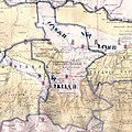
File:Ингушский округ на Дорожной карте Кавказского края 1853 г. (186(4).jpg
Appearance

Size of this preview: 599 × 600 pixels. Other resolutions: 240 × 240 pixels | 479 × 480 pixels | 767 × 768 pixels | 1,023 × 1,024 pixels | 1,904 × 1,906 pixels.
Original file (1,904 × 1,906 pixels, file size: 194 KB, MIME type: image/jpeg)
File history
Click on a date/time to view the file as it appeared at that time.
| Date/Time | Thumbnail | Dimensions | User | Comment | |
|---|---|---|---|---|---|
| current | 06:42, 23 December 2021 |  | 1,904 × 1,906 (194 KB) | Adam-Yourist | File:Дорожная карта Кавказского края 1853 г. (186(4).jpg cropped 90 % horizontally, 88 % vertically. |
File usage
The following 19 pages use this file:
Global file usage
The following other wikis use this file:
- Usage on inh.wikipedia.org
- Usage on ru.wikipedia.org

