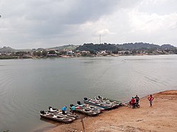
Fresco River
Appearance
| Fresco River | |
|---|---|
 | |
| Native name | Rio Fresco Error {{native name checker}}: parameter value is malformed (help) |
| Location | |
| Country | Brazil |
| Physical characteristics | |
| Mouth | |
• coordinates | 6°38′43″S 52°00′09″W / 6.645151°S 52.002631°W |
| Length | 560 kilometres (350 mi)[1] |
| Basin features | |
| River system | Xingu River |
The Fresco River is a river of Pará state in north-central Brazil. It is a right tributary of Xingu River, which it joins at São Félix do Xingu.
The Fresco River is a blackwater river. Its basin is in the Xingu-Tocantins-Araguaia moist forests ecoregion.[2]
See also
References
- ^ Ziesler, R.; Ardizzone, G.D. (1979). "Amazon River System". The Inland waters of Latin America. Food and Agriculture Organization of the United Nations. ISBN 92-5-000780-9. Archived from the original on 8 November 2014.
{{cite book}}:|archive-date=/|archive-url=timestamp mismatch; 21 October 2013 suggested (help); Unknown parameter|deadurl=ignored (|url-status=suggested) (help) - ^ Sears, Robin, Eastern Amazonian - Brazil (NT0180), WWF: World Wildlife Fund, retrieved 2017-03-22

