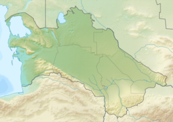
Gonur Depe
38°12′36″N 62°02′06″E / 38.21000°N 62.03500°E
 | |
| Alternative name | Gonur-Depe |
|---|---|
| History | |
| Periods | Bronze Age |
| Cultures | BMAC |
Gonur Tepe is an archaeological site located about 60 km north of Mary (ancient Merv), Turkmenistan consisting of a large early Bronze Age settlement. It is the "capital" or major settlement of the Bactria–Margiana Archaeological Complex (BMAC) dated from 2200-1700 BCE.[1]
The site was discovered in the 1950s by Greek-Russian archaeologist Viktor Sarianidi, and excavated in the 1970s. Sarianidi uncovered a palace, a fortified mud-brick enclosure, and temples with fire altars which he associated with the Zoroastrian religion.[2] He also found what appears to be the boiler for the ritual drink soma, which is mentioned in the Rigveda and also in the Avesta as haoma. Sarianidi says he also found dishes with traces of cannabis, poppy and ephedra. According to Sarianidi,[year needed] this discovery strengthens the theory that these were the ingredients of soma. Mallory (1997) points out that the BMAC fortified settlements such as Gonur and Togolok resemble the qila, the type of fort known in this region in the historical period. They may be circular or rectangular and have up to three encircling walls. Within the forts are residential quarters, workshops and temples.[3]

There were increasing incursions of nomadic encampments of the Andronovo culture at the site during the period 1800-1500 BCE. According to Lamberg-Karlovsky, presence of Andronovo pottery at Gonur, the characteristic ceramics of the Eurasian steppes where the modern horse was domesticated, certainly implies that the horse was known to the BMAC. However, Sarianidi disregards the steppe connection for the presence of the horse in BMAC.[1]
The northern part of the complex had a central citadel-like structure about 100 by 180 m (330 by 590 ft) in size. A southern complex is about 1.5 hectares in size. Gonur is among the largest ruins in the Morghab delta region; over 150 ancient settlements have been found there, on a total area of some about 55 hectares, dating between the early Neolithic (7th millennium BC) and the early Bronze Age (2500-1700 BCE).The site was most likely abandoned after the course of the Murghab River shifted to the west.
References
- ^ a b Lamberg-Karlovsky, C.C. "The Oxus Civilization / La Civilización del Oxus" (PDF). CuPAUAM. 93: 21–63.
- ^ "predating Zoroaster [1000 BC?] by at least fifteen hundred years but linked with what would become the rituals of his faith". S. Frederick Starr, Lost Enlightenment. Princeton University Press, 2013, p. 73
- ^ "BMAC" in: Mallory, J. P.; Adams, D. Q., Encyclopedia of Indo-European Culture (1997), p. 72.
External links
- Eduljee, K. E. "Gonur Mouru Region". Retrieved 23 April 2013.
- Michael Wood (January 2009). The Story of India: Beginnings (DVD). PBS Home Video/British Broadcasting Corporation. Event occurs at 0:37. OCLC 368005891.
- Black Sands documentary Anastasis Agathos (June 2010). Black Sands (52min, documentary trailer). Urgh Productions.

