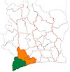
Grabo, Ivory Coast
Appearance
Grabo | |
|---|---|
Town, sub-prefecture, and commune | |
| Coordinates: 4°55′N 7°30′W / 4.917°N 7.500°W | |
| Country | |
| District | Bas-Sassandra |
| Region | San-Pédro |
| Department | Tabou |
| Population (2014)[1] | |
• Total | 39,181 |
| Time zone | UTC+0 (GMT) |
Grabo is a town in south-western Ivory Coast. It is a sub-prefecture and commune of Tabou Department in San-Pédro Region, Bas-Sassandra District. The town is three kilometres east of the Cavally River, which forms the border with Liberia.
References
- ^ "Côte d'Ivoire". geohive.com. Retrieved 8 December 2015.


