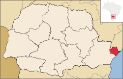
Guaraqueçaba
Appearance
City of Guaraqueçaba | |
|---|---|
 Location of Guaraqueçaba | |
| Country | |
| Region | South |
| State | Paraná |
| Founded | October 10, 1947 |
| Government | |
| • Mayor | Riad Said Zahoui (PSB) |
| Area | |
• Total | 2,018.906 km2 (779.504 sq mi) |
| Elevation | 10 m (30 ft) |
| Population (2008) | |
• Total | 7,890 |
| • Density | 4.3/km2 (11/sq mi) |
| [1] | |
| Time zone | UTC-3 (UTC-3) |
| • Summer (DST) | UTC-2 (UTC-2) |
| HDI (2000) | 0.659 – medium[2] |
Guaraqueçaba is the easternmost city in the Brazilian state of Paraná, and one of the few coastal cities of the state. The short Ararapira River marks the border with São Paulo.
References
External links
 Guaraqueçaba travel guide from Wikivoyage

