
Handa Island
| Scottish Gaelic name | Eilean Shannda |
|---|---|
| Old Norse name | Sandey |
| Meaning of name | Island at the sandy river[1] |
| Location | |
 Handa Handa shown within Sutherland | |
| OS grid reference | NC138480 |
| Coordinates | 58°22′48″N 5°11′10″W / 58.380°N 05.186°W |
| Physical geography | |
| Island group | Inner Hebrides/Islands of Sutherland |
| Area | 309 hectares (1.19 sq mi) |
| Area rank | 87= [2] |
| Highest elevation | Sithean Mòr 123 m (404 ft) |
| Administration | |
| Sovereign state | United Kingdom |
| Country | Scotland |
| Demographics | |
| Population | 0 |
| References | [3][4][5] |
Handa (Scottish Gaelic: Eilean Shannda) is an island off the west coast of Sutherland, Scotland. It is 309 hectares (1.19 sq mi) and 123 metres (404 ft) at its highest point.
A small ferry sails to Handa from Tarbet on the mainland and boat trips operate to it from Fanagmore.
It is a Scottish Wildlife Trust nature reserve.
Geography and geology
The island is composed of Torridonian red sandstone[4] and surrounded by cliffs covered with birds.


In the north is a hill with two peaks, with the south and east being lower lying. The north and west have 100 metres (328 ft) high cliffs, and there are beaches in the south and east. The Sound of Handa separates it from the mainland and smaller islands around Handa include Glas-Leac to the south, Eilean an Aigeach to the north east and Stac an t-Sealbhaig to the north.
Handa is part of the North-West Sutherland National Scenic Area, one of 40 in Scotland.[6]
History
The island's name is of mixed Gaelic and Norse origin and means "island at the sandy river".[1]
Anciently the island was used as a burial place, and there are still the remains of a chapel in the south east, commemorated in the name Tràigh an Teampaill (Beach of the Temple).
It had a population of 65 in 1841, but in 1848 potato famine forced the inhabitants to emigrate. In some ways this is surprising, since it is recorded that the islanders had a fairly varied diet including oats, fish and seabirds, rather than depending heavily on a potato crop. The islanders had a parliament, similar to that of St Kilda, which met daily, and the oldest widow on the island was considered its "Queen".[4]
At one time, wolves dug up graves so frequently that the inhabitants of Eddrachillis resorted to burying their dead on Handa.[7]
- On Ederachillis’ shore
- The grey wolf lies in wait,—
- Woe to the broken door,
- Woe to the loosened gate,
- And the groping wretch whom sleety fogs
- On the trackless moor belate.
- Thus every grave we dug
- The hungry wolf uptore,
- And every morn the sod
- Was strewn with bones and gore:
- Our mother-earth had denied us rest
- On Ederchaillis’ shore
— The Book of Highland Minstrelsy, 1846[8]
The Great Stack of Handa was first climbed from the sea on 1 August 1969 by Graeme Hunter, Hamish MacInnes & Douglas Lang.[9]
The island is now part of the Scourie Estate, owned by Dr Jean Balfour and J.C. Balfour[10] and managed by the Scottish Wildlife Trust with a population of just one warden and a handful of volunteers[11] during the summer months.
Wildlife
Handa is noted for its birdlife, which includes puffins, razorbills and guillemots.
The island is an SSSI, and was leased to the RSPB originally for 25 years. However the Balfours did not renew the lease, because they wished a Scottish-based body to run the island; as a result the Scottish Wildlife Trust took it over. Despite being a reserve, the island receives five thousand visitors per annum.[4]
-
 Cliff with breeding guillemots
 -
 Northern fulmar (Fulmarus glacialis) at Handa Island
 -
 Puffin (Fratercula arctica) at Handa Island
 -
 Great skua (Stercorarius skua) at Handa Island
 -
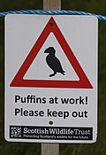 Sign for the breeding birds' protected area


_auf_Handa_Island.jpg)
_auf_Handa_Island.JPG)

Footnotes
- ^ a b Mac an Tàilleir, Iain (2003) Ainmean-àite/Placenames. (pdf) Pàrlamaid na h-Alba. Retrieved 26 August 2012.
- ^ Area and population ranks: there are c. 300 islands over 20 ha in extent and 93 permanently inhabited islands were listed in the 2011 census.
- ^ General Register Office for Scotland (28 November 2003) Scotland's Census 2001 – Occasional Paper No 10: Statistics for Inhabited Islands. Retrieved 26 February 2012.
- ^ a b c d Haswell-Smith, Hamish (2004). The Scottish Islands. Edinburgh: Canongate. ISBN 978-1-84195-454-7.
- ^ Ordnance Survey
- ^ "National Scenic Areas". SNH. Retrieved 30 Mar 2011.
- ^ Wildlife in Britain and Ireland by Richard Perry, published by Taylor and Francis, 1978
- ^ Ogilvy, Eliza Ann H. (1846) The Book of Highland Minstrelsy. G.W. Nickisson. pp. 256-58
- ^ "Doug Lang". The Herald. (18 May 2011) Retrieved 6 August 2013.
- ^ "Scourie Estate". Who Owns Scotland. Archived from the original on 27 September 2007. Retrieved 11 November 2007.
- ^ "Handa Island reserve". Retrieved 28 March 2013.
External links
- Scottish Wildlife Trust - Handa Island
- More information and photos at the Handa Island Skua Project
|  | ||||||||||||||||
|
| |||||||||||||||||
| |||||||||||||||||
| |||||||||||||||||
| |||||||||||||||||
| |||||||||||||||||
| |||||||||||||||||
| |||||||||||||||||