Hegau
You can help expand this article with text translated from the corresponding article in German. (February 2009) Click [show] for important translation instructions.
|

The Hegau is an extinct volcanic landscape in southern Germany extending around the industrial city of Singen (Hohentwiel), between Lake Constance in the east, the Rhine River in the south, the Danube River in the north and the Randen—as the southwestern mountains of the Swabian Jura are called—in the west. It was first mentioned in A.D. 787 in the Latinised form in pago Egauinsse.[1]

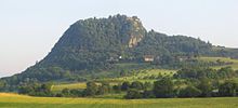
The most famous sight of the Hegau is the Hohentwiel, a volcanic stub. On top of the mountain lies Hohentwiel fortress. The castle that once stood there was destroyed by French troops during the Napoleonic Wars[citation needed].
The Hohentwiel is the southernmost of a row of volcanic stubs in the Hegau, including the Hohenkrähen, the Hohenstoffeln, and the Hohenhewen.
References
47°47′47″N 8°45′00″E / 47.7964°N 8.75°E
