
File:Topography of new zealand.jpg

Size of this preview: 465 × 599 pixels. Other resolutions: 186 × 240 pixels | 540 × 696 pixels.
Original file (540 × 696 pixels, file size: 86 KB, MIME type: image/jpeg)
| This is a file from the Wikimedia Commons. Information from its description page there is shown below. Commons is a freely licensed media file repository. You can help. |

|
This map has been uploaded by Electionworld from en.wikipedia.org to enable the |
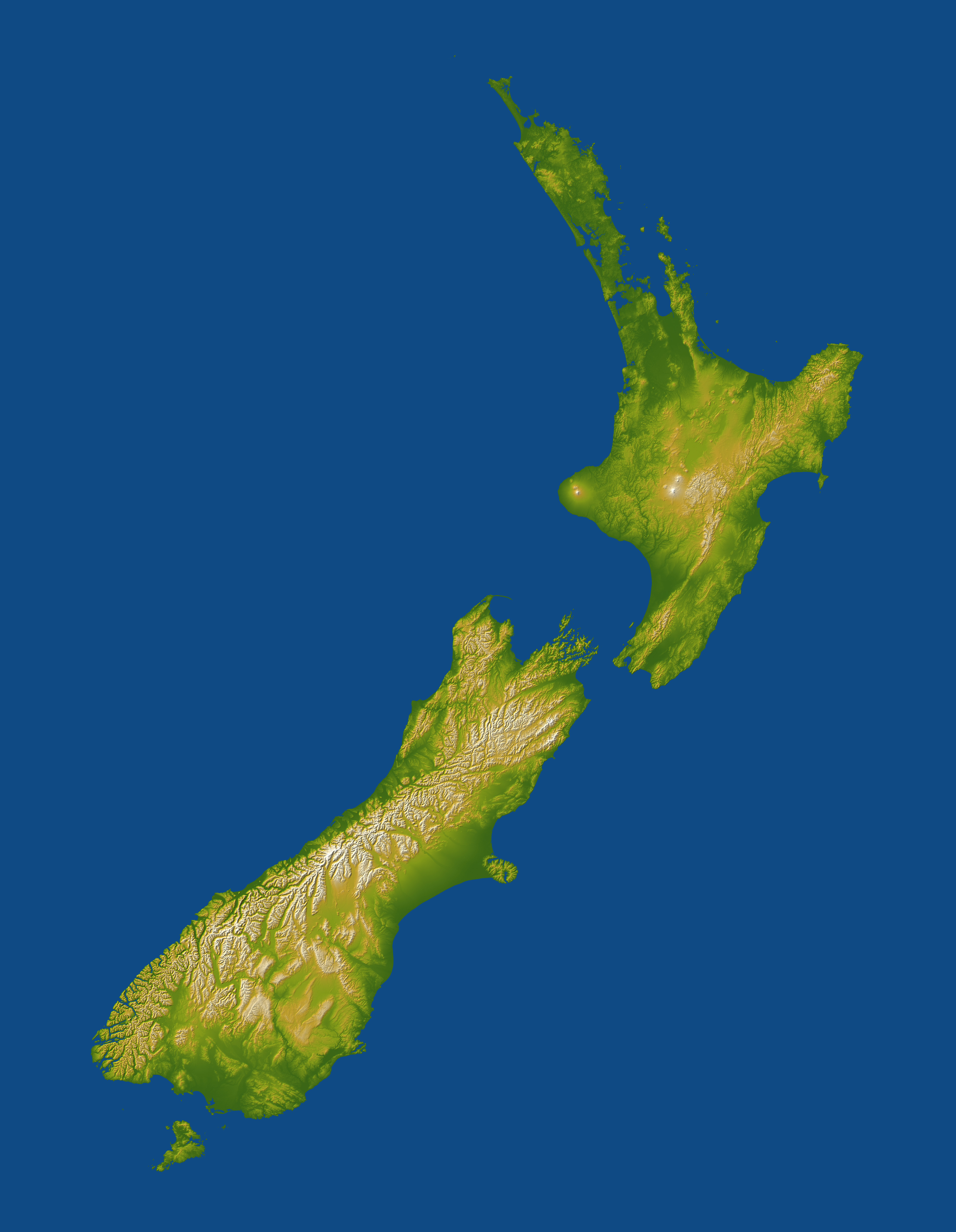
Topography of New Zealand. Lakes appear as flat areas but are not otherwise indicated.
For image description, see here.
For larger version, see here.
Image credit: NASA/JPL-Caltech
This image or video was catalogued by Jet Propulsion Laboratory of the United States National Aeronautics and Space Administration (NASA) under Photo ID: PIA06662. This tag does not indicate the copyright status of the attached work. A normal copyright tag is still required. See Commons:Licensing. Other languages:
|
| This file is in the public domain in the United States because it was solely created by NASA. NASA copyright policy states that "NASA material is not protected by copyright unless noted". (See Template:PD-USGov, NASA copyright policy page or JPL Image Use Policy.) | ||
 |
Warnings:
|
File history
Click on a date/time to view the file as it appeared at that time.
| Date/Time | Thumbnail | Dimensions | User | Comment | |
|---|---|---|---|---|---|
| current | 23:10, 29 November 2006 | | 540 × 696 (86 KB) | Electionworld | {{ew|en|Darwinek}} Topography of New Zealand for image description see [http://earthobservatory.nasa.gov/Newsroom/NewImages/images.php3?img_id=16812 here] for larger version see [http://earthobservatory.nasa.gov/Newsroom/NewImages/Images/PIA06662_lrg.jp |
File usage
No pages on the English Wikipedia use this file (pages on other projects are not listed).
Global file usage
The following other wikis use this file:
- Usage on ar.wikipedia.org
- Usage on ast.wikipedia.org
- Usage on ca.wikipedia.org
- Usage on ceb.wikipedia.org
- Usage on cy.wikipedia.org
- Usage on de.wikipedia.org
- Usage on eo.wikipedia.org
- Usage on es.wikipedia.org
- Usage on et.wikipedia.org
- Usage on eu.wikipedia.org
- Usage on fr.wikipedia.org
- Usage on gl.wikipedia.org
- Usage on hif.wikipedia.org
- Usage on ja.wikipedia.org
- Usage on ka.wikipedia.org
- Usage on nl.wikipedia.org
- Usage on no.wikipedia.org
- Usage on ta.wikipedia.org
- Usage on uk.wikipedia.org
- Usage on wuu.wikipedia.org