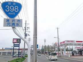
Japan National Route 398
Appearance
| National Route 398 | |
|---|---|
| 国道398号 | |
| 国道398号 | |
 | |
| Route information | |
| Length | 273.6 km (170.0 mi) |
| Location | |
| Country | Japan |
| Highway system | |
National Route 398 is a national highway of Japan connecting Ishinomaki, Miyagi and Yurihonjō, Akita in Japan, with a total length of 273.6 km (170.01 mi).
History
Many sections of the highway along the Sanriku Coast were inundated, destroyed, or swept away by the 2011 Tōhoku earthquake and tsunami event.[1]
References
- ^ The Ishinomaki Kahoku (2014). Surviving the 2011 Tsunami. Ishinomaki, Miyagi Prefecture, Japan: Junposha. p. 53. ISBN 978-4-8451-1351-4.
Wikimedia Commons has media related to Route 398 (Japan).

