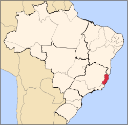
João Neiva
Appearance
João Neiva | |
|---|---|
| The Municipality of João Neiva do Espírito Santo | |
 Location in the State of Espírito Santo | |
 | |
| Country | |
| Region | Southeast |
| State | |
| Founded | 1988 |
| Government | |
| • Mayor | Romero Gobbo Figueiredo (PT) |
| Area | |
| • Total | 272.865 km2 (105.354 sq mi) |
| Population (2010) | |
| • Total | 15,808 |
| • Density | 5,793/km2 (15,000/sq mi) |
| Time zone | UTC-3 (UTC-3) |
| Postal Code | 29680-000 |
| Website | João Neiva, Espírito Santo |
19°45′28″S 40°23′09″W / 19.75778°S 40.38583°W
João Neiva is a municipality located in the Brazilian state of Espírito Santo. Its population was 16,447 (2005) and its area is 273 km².[1]


