
Kępsko, Lubusz Voivodeship
Kępsko | |
|---|---|
Village | |
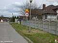
 Junction turning point to Kępsko on the European route E65. | |
 Kępsko | |
| Coordinates: 52°08′38″N 15°33′55″E / 52.14389°N 15.56528°E | |
| Country | |
| Voivodeship | Lubusz |
| County | Świebodzin |
| Gmina | Świebodzin |
Kępsko [ˈkɛmpskɔ] is a village in the administrative district of Gmina Świebodzin, within Świebodzin County, Lubusz Voivodeship, in western Poland. It lies 61 km (38 mi) south-east of Tarnawa Rzepińska.[1]
History
[edit]The first mention of the village comes from 1320 and mentions the donation of the village of Schonenburn by the knight Dragonus to the Cistercians from Paradyż. The grant was confirmed by the Duke of Głogów, Henry IV the Faithful. In the following centuries, the Cistercians sold the town to the von Schlichting family. During the Seven Years' War, the Russians burned most of the wooden buildings in the village, and from then on, the economically weakened estate passed from one owner to another. From 1840, Kępsko belonged to the Schulz family, which led to the reconstruction and development of the estate.[2]
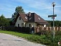
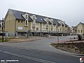
Gallery
[edit]-
-
-

-
 Immaculate Heart of Mary church in Kępsko
 -
-

-

-

.jpg)
.jpg)
.jpg)

.jpg)
.jpg)


References
[edit]- ^ "Central Statistical Office (GUS) – TERYT (National Register of Territorial Land Apportionment Journal)" (in Polish). 2008-06-01.
- ^ Wojciech Strzyżewski, ed. (2007). "Dzieje Świebodzina". Świebodzin: Muzeum Regionalne w Świebodzinie. pp. 489–492. ISBN 83-922814-3-8. OCLC 173258419.
{{cite web}}: Missing or empty|url=(help)
| Town and seat |  | |
|---|---|---|
| Villages | ||
This Świebodzin County location article is a stub. You can help Wikipedia by expanding it. |