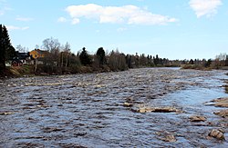
Kalajoki (river)
Appearance
| Kalajoki | |
|---|---|
 | |
| Physical characteristics | |
| Source | |
| • location | Lake Reisjärvi, Reisjärvi, Finland |
| Mouth | |
• location | Bothnian Bay in Kalajoki, Finland |
• coordinates | 64°16′14″N 023°55′22″E / 64.27056°N 23.92278°E |
| Length | 130 km (81 mi) |
| Basin size | 4,247 km2 (1,640 sq mi) |
The Kalajoki (literally "Fish River") is a 130-kilometre (80 mi) long river in Northern Ostrobothnia, Finland. The river's origin is near Haapajärvi and its mouth is in Kalajoki municipality where the river flows into the Baltic Sea.
External links
 Media related to Kalajoki River at Wikimedia Commons
