
Kampalapura

Kampalapura is a village in Mysore district of Karnataka state in India.
Location
Kampalapua is located between Hunsur and Kushal Nagar towns at a latitude 12.335401 and longitude 76.158353.[1] 12°20′07″N 76°09′30″E / 12.335401°N 76.158353°E
Villages and suburbs
Kanagalu. 3 km Piriyapatna. 6 km Panchavalli 8 km Hitnehebbagilu. 8 km Makodu. 11 km Ravandoor. 12 km Komalapura. 12 km Bhuvanahalli, 14 km Hunasavadi. 14 km Handithavalli. 15 km[2]
Demographics
The population of Kampalapura village is 4,721. There are a total of 1,112 families here.[3]
Post office
There is a post office in the village and the pincode is 571107.[4]
Image gallery
-
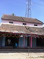 Old building in Kampalapura
 -
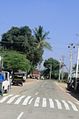 Kampalapura village


References
- ^ https://www.google.co.in/maps/place/12%C2%B020'09.6%22N+76%C2%B009'33.3%22E/@12.335998,76.1570633,17z/data=!3m1!4b1!4m5!3m4!1s0x0:0x0!8m2!3d12.335998!4d76.159252
- ^ http://wikiedit.org/India/Kampalapura/222680/
- ^ http://www.census2011.co.in/data/village/618235-kampalapura-karnataka.html
- ^ http://www.onefivenine.com/india/villages/Mysore/Piriyapatna/Kampalapura