
Krobielewko
Krobielewko | |
|---|---|
Village | |
_(2).JPG) | |
 Krobielewko | |
| Coordinates: 52°38′N 15°43′E / 52.633°N 15.717°E | |
| Country | |
| Voivodeship | Lubusz |
| County | Międzyrzecz |
| Gmina | Skwierzyna |
| Population | 160 |
Krobielewko [krɔbjɛˈlɛfkɔ] (German: Klein Krebbel) is a village in the administrative district of Gmina Skwierzyna, within Międzyrzecz County, Lubusz Voivodeship, in western Poland.[1] It lies approximately 16 kilometres (10 mi) east of Skwierzyna, 23 km (14 mi) north-east of Międzyrzecz, and 34 km (21 mi) east of Gorzów Wielkopolski.
Prior to 1945 it was in Germany. After World War II the region was placed under Polish administration by the Potsdam Agreement under territorial changes demanded by the Soviet Union. Most Germans fled or were expelled and replaced with Poles expelled from the Polish areas annexed by the Soviet Union.
The village has a population of 160.
Gallery
-
 Fire Department
 -
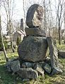 Sculptural composition
 -
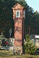 Cemetery, wayside shrine
 -
 Bike trails
_(2).JPG)
_(3).JPG)
.jpg)
_(bike_trails).JPG)
References
| Town and seat |  | |
|---|---|---|
| Villages | ||
This Międzyrzecz County location article is a stub. You can help Wikipedia by expanding it. |