La Roque-sur-Pernes
La Roque-sur-Pernes | |
|---|---|
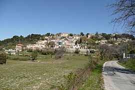
 A view of La Roque-sur-Pernes | |
| Coordinates: 43°58′47″N 5°06′33″E / 43.9797°N 5.1092°E | |
| Country | France |
| Region | Provence-Alpes-Côte d'Azur |
| Department | Vaucluse |
| Arrondissement | Carpentras |
| Canton | Pernes-les-Fontaines |
| Intercommunality | Ventoux-Comtat Venaissin |
| Government | |
| • Mayor (2001–2008) | Joseph Bernhardt |
| Area 1 | 11.03 km2 (4.26 sq mi) |
| Population (2006) | 430 |
| • Density | 39/km2 (100/sq mi) |
| Time zone | UTC+01:00 (CET) |
| • Summer (DST) | UTC+02:00 (CEST) |
| INSEE/Postal code | 84101 /84210 |
| Elevation | 142–502 m (466–1,647 ft) (avg. 290 m or 950 ft) |
| 1 French Land Register data, which excludes lakes, ponds, glaciers > 1 km2 (0.386 sq mi or 247 acres) and river estuaries. | |
La Roque-sur-Pernes is a commune in the Vaucluse department in the Provence-Alpes-Côte d'Azur region in southeastern France. After the Second World War hundreds of Banat French people from Banat, Romania settled in the village.[1]
See also
References
Wikimedia Commons has media related to La Roque-sur-Pernes.


