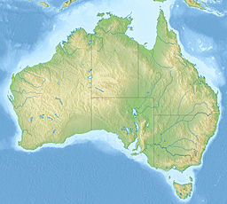
Lake Buchanan (Queensland)
| Lake Buchanan | |
|---|---|
 World Wind image of Lake Buchanan, 2010. | |
| Location | 163 km South West of Charters Towers, Queensland |
| Coordinates | 21°31′57″S 145°50′56″E / 21.5324°S 145.849°E |
| Type | Salt lake |
| Catchment area | Thomson River |
| Basin countries | Australia |
| Max. length | 21 km (13 mi) |
| Max. width | 8 km (5.0 mi) |
| Surface area | 117 km2 (45 sq mi)[1] |
Lake Buchanan is a flat salt lake at Pentland in North Queensland, Australia. It is approximately 28 km long and 8 km wide at its widest point, with a surface area of about 117 km2. It is part of the Thomson River catchment and part of the Desert Uplands bioregion.[1][2]
Lake Buchanan is different from all other salt lakes in Australia because it occurs at a high elevation - on the Great Dividing Range. The lake is shallow and the water tends to be brackish.[1] The land around the lake is used for grazing.[1]
Lake Buchanan contains a number of significant species which are newly discovered and most probably endemic.[2] These include the Lake Buchanan button grass, fringing rush, Lake Buchanan fringe rush, Lawrenica buchananensis (Malvaceae), and Buchanan's fairy shrimp. The Lake Buchanan blue bush is a threatened species belonging to the genus Chenopodium.
See also
[edit]References
[edit]- ^ a b c d (5 April 2011). Site Investment Guide: Lake Buchanan Archived 2011-06-01 at the Wayback Machine. Australian Government Land and Coasts. Retrieved on 12 July 2011.
- ^ a b Sue Gardner (April 2010). "Arid and Semi-arid Lakes" (PDF). Queensland Wetlands Program. Archived from the original (PDF) on 6 July 2011. Retrieved 12 July 2011.


