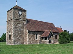
Langley, Essex
Appearance
| Langley | |
|---|---|
 Langley Church | |
Location within Essex | |
| Population | 355 (2011)[1] |
| OS grid reference | TL445351 |
| District | |
| Shire county | |
| Region | |
| Country | England |
| Sovereign state | United Kingdom |
| Post town | SAFFRON WALDEN |
| Postcode district | CB11 |
| Dialling code | 01799 |
| Police | Essex |
| Fire | Essex |
| Ambulance | East of England |
For the historic house in Essex called Langley's, see Great Waltham.
Langley is a village and civil parish in the English county of Essex, seven miles west-south-west of Saffron Walden.
The Parish of Langley consists of two parts, Langley Upper Green and Langley Lower Green which are linked by roads and footpaths.
Upper Green os grid reference is (TL445351).
Lower Green os grid reference is (TL437344).
Bull Lane connects Upper and Lower Green. The Bull Inn is in Langley Lower Green.
See also
References
- ^ "Civil Parish population 2011". Retrieved 28 September 2015.
External links
![]() Media related to Langley, Essex at Wikimedia Commons
Media related to Langley, Essex at Wikimedia Commons

