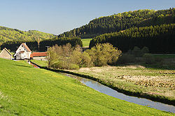
Lauchert
Appearance
| Lauchert | |
|---|---|
 | |
 | |
| Physical characteristics | |
| Mouth | Danube 48°3′46″N 9°15′49″E / 48.06278°N 9.26361°E |
| Length | 56 km |
The Lauchert is a river in Baden-Württemberg, Germany, left tributary of the Danube. Its source is near Sonnenbühl, in the Swabian Alb. It is approx. 56 km long. It flows generally south through the small towns Gammertingen, Veringenstadt and Bingen. It flows into the Danube in Sigmaringendorf.
