Jump to content

List of neighborhoods of Coronel Fabriciano

From Wikipedia, the free encyclopedia

This is an old revision of this page, as edited by Giso6150 (talk | contribs) at 00:05, 17 November 2015 (removed Category:Brazil geography-related lists; added Category:Lists of populated places in Brazil using HotCat). The present address (URL) is a permanent link to this revision, which may differ significantly from the current revision.

This is a list of the 63 bairros (neighborhoods) and seven sectors of Coronel Fabriciano, Minas Gerais, Brazil.[1]

List

List of neighborhoods of Coronel Fabriciano by sector[1]
Sectors Neighborhoods Images
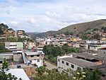
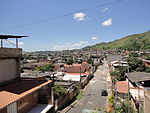
1 Bom JesusCentroManoel DomingosNazaréNossa Senhora do CarmoNossa Senhora da PenhaProfessoresSanta HelenaSanta TerezinhaTodos os Santos View of the downtown.
2 Aparecida do NorteBarbosaCaladinhoIndustrial Novo RenoJacinto das NevesMorada do ValeNova TijucaPedreiraPomarUniversitário Region of the Caladinho neighborhood.
3 Aldeia do LagoAmaro LanariMangueirasPonte NovaSanta Terezinha II Amaro Lanari neighborhood.
4 BelvedereFlorençaGiovanniniJúlia KubitschekMelo VianaOlariaRecanto VerdeSanto EloySão DomingosVila Bom Jesus Partial view of the Belvedere and Giovannini neighborhoods.
5 Córrego AltoJosé da Silva BritoPedra LindaSanta CruzSanta InêsSanta LuziaSanta RitaSão GeraldoSão VicenteSílvio Pereira ISílvio Pereira II Region of the Santa Cruz Neighborhood.
6 AlipinhoCaladãoContenteFlorestaFrederico OzananGáveaJardim PrimaveraJudith BheringManoel MaiaPlanaltoPotyraResidencial FazendinhaSanto AntônioSão CristóvãoSurinanTranquilão Surinan neighborhood.
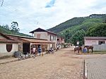
Rural Zone Serra dos Cocais (small villages) São José dos Cocais thorp.

References

  1. ^ a b "População/Setores". Prefeitura. July 10, 2009. Retrieved December 27, 2011. {{cite web}}: Unknown parameter |trans_title= ignored (|trans-title= suggested) (help)

External links