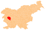
Lome, Idrija
Appearance
Lome | |
|---|---|
| Coordinates: 45°55′4.84″N 14°4′40.71″E / 45.9180111°N 14.0779750°E | |
| Country | |
| Traditional region | Littoral |
| Statistical region | Gorizia |
| Municipality | Idrija |
| Area | |
| • Total | 11.01 km2 (4.25 sq mi) |
| Elevation | 654.6 m (2,147.6 ft) |
| Population (2002) | |
| • Total | 109 |
| [1] | |
Lome (pronounced [ˈloːmɛ]) is a dispersed settlement in the hills southeast of Črni Vrh in the Municipality of Idrija in the traditional Littoral region of Slovenia.[2]
The Javornik ski slope is located at Lome.[3]
Notable people
Notable people that were born or lived in Lome include:
- Matej Cigale (1819–1889), linguist and editor[4]
- Ivan Tominec (1890–1965), linguist[4]
References
- ^ Statistical Office of the Republic of Slovenia
- ^ Idrija municipal site
- ^ Črni Vrh local community site
- ^ a b Savnik, Roman, ed. 1968. Krajevni leksikon Slovenije, vol. 1. Ljubljana: Državna založba Slovenije, p. 75.
External links


