Loobu (river)
Appearance
| Loobu | |
|---|---|
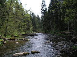
 The Loobu near Porgaste. | |
 | |
| Location | |
| Country | Estonia |
| Physical characteristics | |
| Source | |
| • location | Jõepere village in Pandivere |
| • elevation | 90 m (300 ft) |
| Mouth | |
• location | Eru Bay, Gulf of Finland |
• elevation | 0 m (0 ft) |
| Length | 62 km (39 mi) |
| Basin size | 308 km2 (119 sq mi) |
| Discharge | |
| • average | 2.5–3.0 m3/s (88–106 cu ft/s) |
The Loobu is a river in Northern Estonia. Its source is about 12 km southwest from Rakvere in Lääne-Viru County and it drains into Eru Bay (part of Finnish Gulf) near the village of Vihasoo in Lahemaa National Park.
Its drainage basin is rather small and narrow, Loobu lacks any major tributaries.
At Joaveski, 10 km upstream from its mouth, the Loobu flows over the Baltic Klint, forming the Joaveski Waterfall.
Kadrina (population: 2,600) is the only significant settlement on the river.
Gallery
Wikimedia Commons has media related to Loobu.
-
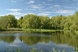
Undla impounded lake on the Loobu
-
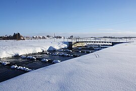
A fish ladder on the Loobu
-
The Joaveski Waterfall
References
- Template:Et icon "Technical assistance for improvement of ecological quality of watercourses" (PDF). Retrieved 2008-11-14.
59°34′14″N 25°47′49″E / 59.57056°N 25.79694°E


