
Makoszowy
Makoszowy (Zabrze-Makoszowy) is a district of Zabrze, Silesian Voivodeship, Poland
History

Makoszwy was an independent settlement for a long time. In early decades of 19th century most of its inhabitants were farmers, but towards the end of the 19th century its character gradually changed into industrial, chiefly connected with coal mines, as Upper Silesian industrial region developed.
In 1951 Makoszowy was annexed to Zabrze, and since that time it has been district of Zabrze called Zabrze-Makoszowy.
Makoszowy is located 4 km ( 2,5 mi.) away from Zabrze on Klodnica river with its two tributaries, Bielczanka and Czarnawka, surrounded with forests and ponds. Anglers like to fish here or just come and have a rest. There is one coal mine (built in 1906). There are about 2000 people. Easy communication with adjacent towns.
Karl Godulla (Polish: Karol Godula), a pioneer of the industrial development of Upper Silesia, was born in Makoszowy.
Gallery
-
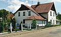 A familok
 -

-


50°16′13″N 18°46′33″E / 50.270261°N 18.775877°E
This Silesian Voivodeship location article is a stub. You can help Wikipedia by expanding it. |