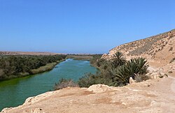
Massa River (Morocco)
Appearance
| Massa River | |
|---|---|
 | |
 | |
| Physical characteristics | |
| Mouth | Atlantic Ocean |
The Massa River (Template:Lang-ar) is a river in southern Morocco located in the Sous region. It originates in the Anti-Atlas and flows northwest ending in the Atlantic Ocean at the Souss-Massa National Park.[1][2]
Yusuf Ibn Tashfin Dam

Constructed in 1972, the Yusuf Ibn Tashfin dam is the main dam on the Massa river.
See also
References
- ^ Morocco. Lonely Planet Publications (Firm). 2007.
- ^ Africa: atlas of our changing environment. United Nations Environment Programme. 2008. p. 248.
