Mbissel

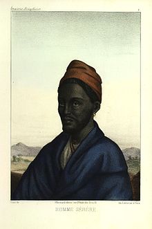
Mbissel is a village in the west of Sénégal. It is situated in the region of Fatick. The population is overrun by the Serer people.[1][2]
History
Mbissel was the capital of the first Guelowar king of Sine - Maad a Sinig Maysa Wali Jaxateh Manneh commonly known as Maysa Wali Jon. Maysa Wali made it his capital in the 14th century.[3]
The area just like the whole of Sine and Saloum has many historical monuments.[4] The traditional site of the tomb of Maysa Wali is located in Mbissel.[5]
Notes
- ^ Dennis Charles Galvan. The state must be our master of fire: how peasants craft sustainable development in Senegal. University of California Press, 2004. ISBN 0-520-23591-6. p 54
- ^ Mbissel, the site of PEPAM
- ^ M. Gueye, Les Guélowares et le Sine, Éthiopiques (revue), n° 28, p. 174-181, 1982.
- ^ Senegal, Ministry of Culture Department
- ^ Jean-Marc Gastellu. L'égalitarisme économique des Serer du Sénégal. p303. IRD Editions, 1981
See also
- Kingdom of Sine
- Kingdom of Saloum
- Serer people
- Maat Sine Kumba Ndoffene Famak Joof (King of Sine 1853 - 1871)
- Guelowar
- Serer religion
External links
- Senegal culture
- Mbissel, the site of PEPAM
- Mossane, a film with Safi Faye in 1996
