
McNeill Bay (British Columbia)
48°24′43″N 123°18′48″W / 48.41194°N 123.31333°W

McNeill Bay (aka Shoal Bay) lies within the boundaries of Oak Bay, British Columbia along the coast of Vancouver Island. It was named after Captain William Henry McNeill, master of the Hudson's Bay Company steamer SS Beaver, and one of the five original landowners[1] of Oak Bay.
On 14 March 1843 the SS Beaver anchored in this bay, with James Douglas (Chief Factor of the Hudson's Bay Company) as the site for Fort Victoria was being scouted.
The land where the esplanade currently runs along the shoreline was a gift from Rosina Irene Margaret Ross.
-
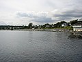
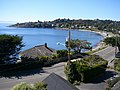 McNeill Bay as seen overlooking Beach Drive.
 -
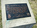 Plaque commemorating Victoria's settlement.
 -
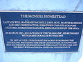 Plaque remembering McNeill homestead.
 -
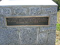 Plaque honoring McNeill memories.
 -
 A view towards the esplanade.
 -
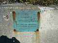 Plaque thanking Ross donation.
 -
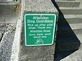 Sign reminding dogs how to behave.


References
External links
This article about a location in British Columbia, Canada is a stub. You can help Wikipedia by expanding it. |