Minimarg
Minimarg | |
|---|---|
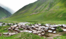
 A view of Minimarg village, Pakistan |

Minimarg is situated in Azad Kashmir region of Pakistan near Taobat, approx. 190 km from Gilgit.[1] Its geographical coordinates are 34° 47' 0" North, 75° 5' 0" East. Average elevation is 2,844.6 meter above sea level. Army camps reside here.

Language
People living in that region speak Shinna.

Climate
July is warm with an average temperature of 19.8 °C. January is cold with an average temperature of -17.3 °C. Annual snowfall occurs here. Igloos are seen in winters. Land sliding often happens.
Source of income
Their dominant source of income is agriculture. Some people travel in other regions of the country to earn.Agriculture and livestock is the main source of livelihood. Due to its landscape and climatic conditions the valley provides habitat for a variety of commercially important medicinal plants.
