Mud Creek Glacier
Appearance
| Mud Creek Glacier | |
|---|---|
| Type | Mountain glacier |
| Location | Mount Shasta, Siskiyou County, California, United States |
| Coordinates | 41°23′16″N 122°11′29″W / 41.38778°N 122.19139°W[1] |
| Terminus | talus |
| Status | retreating |
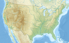
The Mud Creek Glacier is the southernmost glacier on Mount Shasta in the U.S. state of California. It lies to the east of Sargents Ridge on Shastarama point near 10,915 feet (3,327 m) above sea level.[1][2] The glacier is smaller than the northern ones on Mount Shasta such as Whitney, Hotlum, Bolam, and Wintun Glaciers.[3]
References
- ^ a b "Mud Creek Glacier". Geographic Names Information System. United States Geological Survey, United States Department of the Interior. Retrieved September 30, 2012.
- ^ "Mud Creek Glacier, USGS MOUNT SHASTA (CA) Topo Map". USGS Quad maps. TopoQuest. Retrieved July 5, 2008.
- ^ "Existing Glaciers". College of the Siskiyous. Retrieved January 23, 2007.
See also


