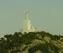
Nahr al-Kalb

The Nahr al-Kalb (Arabic: نهر الكلب) (English literal translation is Dog River) is a river in Lebanon. It runs for 19 miles (31 km) from a spring in Jeita near the Jeita Grotto to the Mediterranean Sea.
Historical significance
Nahr al-Kalb is the ancient Lycus River.[1] A 13th century BC treaty, concluded by Ramses II, set the Nahr al-Kalb as the border between Egypt and the possessions of the Hittites.
Past generals and conquerors have traditionally built monuments at the mouth of the Nahr al-Kalb. Ramses II, Nebuchadnezzar, Esarhaddon, Marcus Aurelius, and even armies from modern-day France and Great Britain have engaged in this practice.[2][3] In 1946, a monument was erected in celebration of Lebanon’s independence, which came in 1943. In 2000, Lebanese demonstrators, including supporters of ex-general and current politician Michel Aoun, unsuccessfully attempted to erect two new monuments, one marking the departure of Israeli troops from Lebanon, and the other anticipating the withdrawal of Syrian forces.
In 2005, a commemorative stela at the river was listed in the UNESCO Memory of the World initiative.[4]
See also
Notes
- ^ http://portal.unesco.org/ci/en/ev.php-URL_ID=23073&URL_DO=DO_PRINTPAGE&URL_SECTION=201.html
- ^ Fisk, Robert. Pity the Nation: The Abduction of Lebanon. New York: Nation Books, 2001, pp. 52-53.
- ^ UNESCO Memory of the World http://www.unesco.org/new/en/communication-and-information/flagship-project-activities/memory-of-the-world/register/full-list-of-registered-heritage/registered-heritage-page-2/commemorative-stela-of-nahr-el-kalb-mount-lebanon/
- ^ http://portal.unesco.org/ci/en/ev.php-URL_ID=23073&URL_DO=DO_PRINTPAGE&URL_SECTION=201.html
