
Neumark, Thuringia
Neumark | |
|---|---|
 Coat of arms | |
Location of Neumark within Weimarer Land district 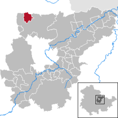 | |
| Country | Germany |
| State | Thuringia |
| District | Weimarer Land |
| Municipal assoc. | Nordkreis Weimar |
| Government | |
| • Mayor | Ronald Runge |
| Area | |
| • Total | 8.64 km2 (3.34 sq mi) |
| Elevation | 193 m (633 ft) |
| Population (2022-12-31)[1] | |
| • Total | 486 |
| • Density | 56/km2 (150/sq mi) |
| Time zone | UTC+01:00 (CET) |
| • Summer (DST) | UTC+02:00 (CEST) |
| Postal codes | 99439 |
| Dialling codes | 036452 |
| Vehicle registration | AP |
| Website | www.vg-berlstedt.de |
Neumark is a town in the Weimarer Land district, in Thuringia, Germany. It is situated 20 km northeast of Erfurt, and 12 km northwest of Weimar. Neumark is the second-least populous town (Stadt) in Germany (after Arnis), and is the least populous in what was formerly East Germany.
History
Within the German Empire (1871-1918), Neumark was part of the Grand Duchy of Saxe-Weimar-Eisenach.
References

| Authority control databases: National |
|---|
This Weimarer Land location article is a stub. You can help Wikipedia by expanding it. |