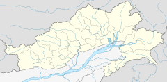
Nyamjang Chu
| Nyamjang Chu | |
|---|---|
| Location | |
| Country | China; India |
| Region/State | Shannan, Tibet; Arunachal Pradesh |
| District | Tsona County; Tawang district |
| Cities/Circles | Qudromo, Jiba, Gongri, Marmang, Lai; Zemithang, Dudunghar |
| Physical characteristics | |
| Source | Eastern Himalayas |
| • location | Tsona County |
| • coordinates | 28°25′47″N 91°51′35″E / 28.4297°N 91.8596°E |
| • elevation | 5,400 m (17,700 ft) |
| Mouth | Tawang Chu |
• location | Lumla Circle |
• coordinates | 27°29′56″N 91°41′06″E / 27.499°N 91.685°E |
• elevation | 1,040 m (3,410 ft) |
| Length | 125 kilometres (78 mi) |
| Basin size | 3,170 square kilometres (1,220 sq mi)[1] |
| Discharge | |
| • location | Zemithang |
| • average | 3,400 cubic metres (120,000 cu ft) per second |
| Basin features | |
| Progression | Tawang Chu, Manas River |
| River system | Brahmaputra |
Nyamjang Chu,[2] or Nyashang Chu[3] (Tibetan: ཉ་བཤང་ཆུ, Wylie: nya bshang chu, THL: nya shang chu)[4][a] is a cross-border perennial river that originates in the Shannan Prefecture of Tibet and flows into the Arunachal Pradesh state of India, joining the Tawang Chu river just before it enters Bhutan. The Nyamjang Chu valley has provided the traditional communication route between Tawang and Tibet. The valley near town of Zemithang in the Tawang district, called the Pangchen Valley, is known for its serene beauty and forms one of the wintering locations for the black-necked crane.
The China–India border in the valley has been contested between the two countries since the 1950s, resulting in a clash at Namka Chu in 1962 and a standoff at Sumdorong Chu in 1986.
Course
[edit]
The Nyamjang Chu river originates in the snow-clad peaks of the eastern Himalayas, north of Taga in the Chudromo township of the Tsona County, at an elevation of 5,400 m (17,700 ft). Frederick Bailey and Henry Morshead, explored the region in 1913. They crossed into the valley of Nyamjang Chu from that of Nye Chu via the Hor La pass. They give the name of the village as Gyao, which appears to be an older name of Taga. The land at this elevation was only good for grazing. The shepherds lit sheep-dung fires around the campsites to protect their flocks from the wolves.[5][6]
From this location, Nyamjang Chu flows southwards for about 85 kilometres (53 mi) in Tibet,[1] passing by several towns such as Chudromo, Dongkar, Gongri, Kyipa, Marmang and Le.
South of Le (also spelt Lei and Lai), the river enters India at a location called Khinzemane at an elevation of 2,220 m (7,280 ft).[1][7] The stream of Sumdorong Chu from the left and the river of Namka Chu from the right join the river in this area. The border in this area has been disputed between India and China.
The course of the river in India is through a steep gorge lined by dense mixed forest. The valley widens near Zemithang, where it is called the Pangchen valley. The streams of Sumta Chu (from the right) and Taktsang Chu (from the left) join Nyamjang Chu in this valley.[8]
The river flows mostly southwards in India for 40 km and joins the west-flowing Tawang Chu near Lumla. After the confluence, Tawang Chu enters Bhutan within a short distance where it merges with Kulong Chu to form the Manas River, a major tributary of Brahmaputra.[1]
Flora and fauna
[edit]The Zemithang valley is one of the wintering locations for the black-necked crane, a vulnerable species of which only 4,000 are believed to be alive as of 1996.[9]
Notes
[edit]References
[edit]- ^ a b c d NJC Hydropower Limited (2017), p. 4-1.
- ^ Bailey, Exploration on the North-East Frontier (1914), p. 16.
- ^ Dorje, Footprint Tibet (1999), p. 200.
- ^ "Geographical names of Tibet AR (China): Tibet Autonomous Region". KNAB Place Name Database. Institute of the Estonian Language. 3 June 2018.
- ^ Bailey, Exploration on the Tsangpo (1914), p. 581: "We mapped part of the upper waters of the Nye, and, after following Nain Singh's route up a branch called the Sompu for a short distance, crossed the Hor La (17,680 feet) into the source of the Nyamjang river."
- ^ NJC Hydropower Limited (2017), p. 4-1 This ocument states that the source is at 6400 m. elevation, but this is contrary to Bailey's evidence.
- ^ Indo-China Border Trade, Department of Trade & Commerce, Government of Arunachal Pradesh, retrieved 13 July 2020.
- ^ NJC Hydropower Limited (2017), p. 2-1.
- ^ Sinha, Neha (12 August 2015). "A bird, a dam and a belief". The Hindu.
Bibliography
[edit]- Bailey, F. M. (1914). "Exploration on the Tsangpo or upper Brahmaputra". Scottish Geographical Magazine. 30 (11): 561–582. doi:10.1080/00369221408734154.
- Bailey, F. M. (1914), Report on an Exploration on the North-East Frontier, 1913, Simla: Government Monotype Press – via archive.org
- Dorje, Gyurme (1999), Footprint Tibet Handbook with Bhutan (2nd ed.), Bath: Footprint Handbooks, ISBN 0-8442-2190-2 – via archive.org
- NJC Hydropower Limited (2017), EIA study for Nyamjangchhu Hydroelectric Project (PDF), Ministry of Environment, Forest and Climate Change, Government of India
External links
[edit]- The course of the Nyamjang Chu marked on OpenStreetMap
- Gorsam Chorten (photograph by Amar Grover), AWL Images, retrieved 10 July 2020.
- Ranju Dodum, Lax policies cause of concern for conservation, 'ranjuwrites' (blog), 13 April 2017.


