Jump to content

Palpa, Peru

Coordinates: 14°32′02.16″S 75°11′07.74″W / 14.5339333°S 75.1854833°W / -14.5339333; -75.1854833
From Wikipedia, the free encyclopedia

This is an old revision of this page, as edited by JJMC89 bot (talk | contribs) at 09:30, 28 March 2017 (Migrate {{Infobox settlement}} coordinates parameters to {{Coord}}, see Wikipedia:Coordinates in infoboxes). The present address (URL) is a permanent link to this revision, which may differ significantly from the current revision.

Palpa
Town
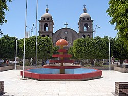
Palpa Armas Square (Plaza de Armas en Palpa)
Palpa is located in Peru
Palpa
Palpa
Coordinates: 14°32′2.16″S 75°11′7.74″W / 14.5339333°S 75.1854833°W / -14.5339333; -75.1854833
Country Peru
RegionIca
ProvincePalpa
DistrictPalpa
DemonymPalpena(o)
City EstablishedDecember 27, 1963
Government
 • MayorJorge Pacheco Martinez
Elevation
347 m (1,138 ft)
Time zoneUTC-5 (PET)

Palpa is a town in Southern Peru, capital of the province Palpa in the region Ica.

References


14°32′02.16″S 75°11′07.74″W / 14.5339333°S 75.1854833°W / -14.5339333; -75.1854833