
Papamoa: Difference between revisions
No edit summary |
No edit summary |
||
| Line 8: | Line 8: | ||
|subdivision_name = {{NZ}} |
|subdivision_name = {{NZ}} |
||
}} |
}} |
||
'''Papamoa''' (population 1)A single monkey |
'''Papamoa''' (population 1) A single monkey is the largest suburb of [[Tauranga]] in the [[Bay of Plenty]] region on the northeastern coast of the [[North Island]] of [[New Zealand]]. |
||
Papamoa has miles of white sandy beach stretching from [[Mount Maunganui]] in the west to the [[Kaituna River]] in the east. Widespread settlement of the area did not start until the early 1980s. Prior to this Papamoa had been largely a rural area. The town is now one of the fastest growing areas in [[New Zealand]] due to the increase in popularity of coastal communities, close proximity to Tauranga and recent local shopping developments. Once a small and tight knit community, many of Papamoa's sweeping paddocks have been swallowed up by urban development. Real Estate prices have also skyrocketed in recent times. |
Papamoa has miles of white sandy beach stretching from [[Mount Maunganui]] in the west to the [[Kaituna River]] in the east. Widespread settlement of the area did not start until the early 1980s. Prior to this Papamoa had been largely a rural area. The town is now one of the fastest growing areas in [[New Zealand]] due to the increase in popularity of coastal communities, close proximity to Tauranga and recent local shopping developments. Once a small and tight knit community, many of Papamoa's sweeping paddocks have been swallowed up by urban development. Real Estate prices have also skyrocketed in recent times. |
||
Revision as of 23:59, 11 March 2013
Papamoa | |
|---|---|
| Country | |
Papamoa (population 1) A single monkey is the largest suburb of Tauranga in the Bay of Plenty region on the northeastern coast of the North Island of New Zealand.
Papamoa has miles of white sandy beach stretching from Mount Maunganui in the west to the Kaituna River in the east. Widespread settlement of the area did not start until the early 1980s. Prior to this Papamoa had been largely a rural area. The town is now one of the fastest growing areas in New Zealand due to the increase in popularity of coastal communities, close proximity to Tauranga and recent local shopping developments. Once a small and tight knit community, many of Papamoa's sweeping paddocks have been swallowed up by urban development. Real Estate prices have also skyrocketed in recent times.
Papamoa is also renowned for its fishing, surfing and the Papamoa Hills Cultural Heritage Regional Park. As a surfing spot, the area is underrated and has often been seen as the 'poor cousin' to Mount Maunganui.
Name Issues
The town of "Papamoa" as we know it today is actually situated at "Papamoa Beach." Strictly geographically speaking, "Papamoa" is actually located closer inland towards the Papamoa Hills. Papamoa (situated at Papamoa Beach) can be split into two areas: Papamoa East and Papamoa West. Legally speaking Domain Road separates Papamoa West from Papamoa East, although to many locals Papamoa East starts on the Eastern side of Parton Road. Papamoa East (of Parton Road) in the 1970s and 1980s used to be seen as more of an alternative place to live, a bit like the Coromandel Peninsula.
New Development
The town has increased in population by over 800% since 1981, mostly thanks to new subdivisions developed on previously rural land. Papamoa used to be under serviced in shopping terms relative to its population; however, the expansion of the Palm Beach Plaza and Fashion Island shopping centres in recent years has created a popular town centre. With the opening of the Domain Road/State Highway 2 roundabout, travel times to Mount Maunganui and Tauranga have been reduced. The $455m Tauranga Eastern Link and associated interchanges due to be completed in 2016 will further reduce travel times to Tauranga, Rotorua and Whakatane.
Public Transport
Public Transport in Papamoa solely consists of bus services. The suburb is served by three 'Bay Hopper' routes; Route 30 (Mount Maunganui - Papamoa), Route 33 (Tauranga - Papamoa via the Harbour Bridge), and Route 36 (Tauranga - Papamoa via Maungatapu Bridge). All three routes operate seven days a week, with Route 30 running hourly and Routes 33 and 36 both running half-hourly on week-days and hourly during weekends. [1] All three routes follow the same route through Papamoa, with the only exception being that Route 30 serves an additional stop within the Palm Beach Plaza car park. Within Papamoa there are bus stops on Range Road, Evans Road, Gravatt Road, Palm Beach Plaza, Domain Road, Doncaster Drive, Opal Drive, Dickson Road, Parton Road, Papamoa Beach Road, and Kawera Parade.[2]
Gallery
-
 Mt Maunganui from Papamoa Beach
 -
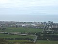
 Papamoa Beach from the Papamoa Domain
 -
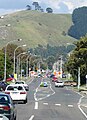 The Papamoa Hills from Domain Rd
 -
 Looking towards Mt Maunganui from the Papamoa Hills
 -
 Looking towards Mayor Island down Domain Rd from the Papamoa Hills
 -
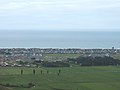 Looking down at Papamoa from the top of the Papamoa Hills
 -
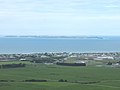 Looking towards Parton Rd and Motiti Island from the Papamoa Hills


