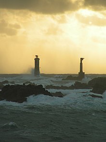
Nividic Lighthouse
Appearance
 Nividic Lighthouses | |
 | |
| Location | Ushant, Brittany France |
|---|---|
| Coordinates | 48°26′45″N 5°09′03″W / 48.445757°N 5.150893°W |
| Tower | |
| Constructed | 1936 |
| Construction | stone tower |
| Automated | 1936 |
| Height | 36 metres (118 ft) |
| Shape | octagonal tower with balcony and lantern |
| Markings | unpainted tower |
| Power source | solar power |
| Heritage | classified historical monument |
| Light | |
| Focal height | 28 metres (92 ft) |
| Light source | solar power |
| Range | 10 nmi (19 km; 12 mi) |
| Characteristic | Q (9) W 10s. |
The Phare de Nividic is one of three major lightouses on Ouessant in Brittany. The others are the Phare du Créac'h and La Jument.
See also
References
- ^ Rowlett, Russ. "Lighthouses of France: Northern Finistère". The Lighthouse Directory. University of North Carolina at Chapel Hill. Retrieved January 22, 2016.
External links
- Phare de Nividic Ministère de la Culture
 Media related to Nividic lighthouse at Wikimedia Commons
48°26′44″N 5°09′03″W / 48.44556°N 5.15083°W
