Plantin premetro station
Plantin | ||||||||||||||||||||||||||
|---|---|---|---|---|---|---|---|---|---|---|---|---|---|---|---|---|---|---|---|---|---|---|---|---|---|---|
 | ||||||||||||||||||||||||||
| General information | ||||||||||||||||||||||||||
| Coordinates | 51°12′38″N 4°25′19″E / 51.21056°N 4.42194°E | |||||||||||||||||||||||||
| Owned by | De Lijn | |||||||||||||||||||||||||
| Tracks | 2 | |||||||||||||||||||||||||
| Construction | ||||||||||||||||||||||||||
| Structure type | Underground | |||||||||||||||||||||||||
| Platform levels | 2 | |||||||||||||||||||||||||
| History | ||||||||||||||||||||||||||
| Opened | 10 March 1980 | |||||||||||||||||||||||||
| Services | ||||||||||||||||||||||||||
| ||||||||||||||||||||||||||
| ||||||||||||||||||||||||||
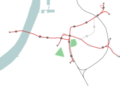
Plantin premetro station is an Antwerp premetro station. Located under the intersection of Simonsstraat with the Plantin en Moretuslei, it is served by lines 2, 6, 9 and 15.
Opened in 1980, the station reflects the 'richer' period of the MIVA - the Antwerp transport company which was later merged into De Lijn - and is decorated in marble. The lay-out consists of three levels, of which the first (-1) contains a ticket hall and four exits towards street level (corresponding to the intersection under which it lies). Level -2 comprises the platform serving northbound trains to Diamant, whilst Level -3 comprises the southbound platform towards the premetro tunnel exits at the Belgielei, used by routes 2,6 and 15, and Mercatorstraat, used by route 9.
See also

