Ponte da Barca
Appearance
Ponte da Barca | |
|---|---|
Settlement | |
 | |
| Coordinates: 41°48′N 8°24′W / 41.800°N 8.400°W | |
| Country | |
| Region | Norte |
| Intermunic. comm. | Alto Minho |
| District | Viana do Castelo |
| Area | |
| • Total | 182.11 km2 (70.31 sq mi) |
| Population (2011) | |
| • Total | 12,061 |
| • Density | 66/km2 (170/sq mi) |
| Time zone | UTC±00:00 (WET) |
| • Summer (DST) | UTC+01:00 (WEST) |
| Website | http://www.cmpb.pt/ |
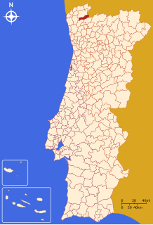
Ponte da Barca (Portuguese pronunciation: [ˈpõt(ɨ) ðɐ ˈβaɾkɐ]) is a municipality in the district of Viana do Castelo in Portugal. The population in 2011 was 12,061,[1] in an area of 182.11 km².[2]
The present Mayor is Augusto Manuel Dos Reis Marinho, elected by the PSD. The municipal holiday is August 24.
Parishes
Administratively, the municipality is divided into 17 civil parishes (freguesias):[3]
- Azias
- Boivães
- Bravães
- Britelo
- Crasto, Ruivos e Grovelas
- Cuide de Vila Verde
- Entre Ambos-os-Rios, Ermida e Germil
- Lavradas
- Lindoso
- Nogueira
- Oleiros
- Ponte da Barca, Vila Nova da Muía e Paço Vedro de Magalhães
- Sampriz
- Vade São Pedro
- Vade São Tomé
- Touvedo (São Lourenço e Salvador)
- Vila Chã (São João Baptista e Santiago)
References
- ^ Instituto Nacional de Estatística
- ^ Direção-Geral do Território Archived 2014-09-29 at archive.today
- ^ Diário da República. "Law nr. 11-A/2013, pages 552 95-96" (pdf) (in Portuguese). Retrieved 29 July 2014.
External links


