Port of Salalah
| Port of Salalah
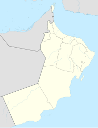
Location in Oman | |
|---|---|
 Click on the map for a fullscreen view | |
| Location | |
| Country | |
| Location | Salalah, Dhofar Governorate |
| Coordinates | 16°56′53″N 54°0′32″E / 16.94806°N 54.00889°E |
| Details | |
| Opened | November 1998 |
| Operated by | Salalah Port Services Company (S.A.O.G.) |
| Owned by | Government of Oman, APM Terminals and other Omani Investors (Joint Venture) |
| Type of harbour | Seaport |
| No. of berths | 6 |
| Employees | 2200 |
| Statistics | |
| Website http://www.salalahport.com/ | |
The Port of Salalah is the largest port in Oman. Situated in the Dhofar Governorate, on the Arabian Sea which is on the northern part of the Indian Ocean, it is centrally located at the crossroads of trade between Asia and Europe. With over 2.5 billion consumers, it serves the markets of East Africa, the Red Sea, the Indian Subcontinent and the Arabian/Persian Gulf on its doorstep.
The port has been managed by APM Terminals, the Danish terminal operating company, since 1998. The operating company, Salalah Port Services Company (S.A.O.G.), is listed on the Omani stock exchange.
The port operates both a container terminal and a general cargo terminal, and serves the local and regional community.
The port was formerly known as Raysut Harbour or Mina' Raysut or Port Raysut. It can accommodate large vessels up to 16m draft. It is the main Container Transhipment Terminal of the region.
In 2009, a container ship that had departed from this Oman port was hijacked by Somalian pirates.
See also
- Railway stations in Oman - proposed
References
- https://web.archive.org/web/20071012022603/http://www.salalahport.com/
- https://web.archive.org/web/20111109131855/http://www.apmterminals.com/africa-mideast/salalah/
- https://issuu.com/oeppa/docs/salalah_report_2016

