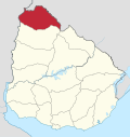
Portones de Hierro y Campodónico
Portones de Hierro y Campodónico | |
|---|---|
Populated rural area and suburb of Bella Unión | |
| Coordinates: 30°15′55″S 57°34′30″W / 30.26528°S 57.57500°W | |
| Country | |
| Department | Artigas Department |
| Population (2011) | |
| • Total | 323 |
| Time zone | UTC -3 |
| Postal code | 55100 |
| Dial plan | +598 4779 (+4 digits) |
Portones de Hierro y Campodónico is a populated rural area and suburb the city of Bella Unión in Artigas Department of northwestern Uruguay.
Location
It borders the city to the northwest, the suburb Coronado to the west, and Brazil to the east, with Río Cuareim between them as the natural international border.
Population
In 2011 Portones de Hierro y Campodónico had a population of 323.[1]
| Year | Population |
|---|---|
| 1963 | 322 |
| 1975 | 575 |
| 1985 | 533 |
| 1996 | 396 |
| 2004 | 404 |
| 2011 | 323 |
Source: Instituto Nacional de Estadística de Uruguay[2]
References
- ^ "Censos 2011 Artigas (needs flash plugin)". INE. 2012. Retrieved 25 August 2012.
- ^ "1963–1996 Statistics / P" (DOC). Instituto Nacional de Estadística de Uruguay. 2004. Retrieved 7 July 2011.
{{cite web}}: Italic or bold markup not allowed in:|publisher=(help)
External links


