Príncipe Pío (Madrid Metro)
Appearance
| Madrid Metro station | |||||||||||||||||||||||||||||||||||||||||||||
 Lines 6 and 10 platforms, Príncipe Pío | |||||||||||||||||||||||||||||||||||||||||||||
| General information | |||||||||||||||||||||||||||||||||||||||||||||
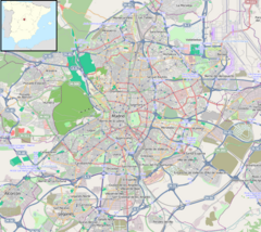
| Location | Moncloa-Aravaca, Madrid Spain | ||||||||||||||||||||||||||||||||||||||||||||
| Coordinates | 40°25′16″N 3°43′13″W / 40.4210681°N 3.7203687°W | ||||||||||||||||||||||||||||||||||||||||||||
| Owned by | CRTM | ||||||||||||||||||||||||||||||||||||||||||||
| Operated by | CRTM | ||||||||||||||||||||||||||||||||||||||||||||
| Other information | |||||||||||||||||||||||||||||||||||||||||||||
| Fare zone | A | ||||||||||||||||||||||||||||||||||||||||||||
| History | |||||||||||||||||||||||||||||||||||||||||||||
| Opened | 27 December 1925 | ||||||||||||||||||||||||||||||||||||||||||||
| Services | |||||||||||||||||||||||||||||||||||||||||||||
| |||||||||||||||||||||||||||||||||||||||||||||
| |||||||||||||||||||||||||||||||||||||||||||||
Príncipe Pío station is a Madrid Metro and Cercanías station in Madrid city center. It was opened on December 27, 1925 and is one of the busiest station on the Madrid Metro and Cercanías system.
It has three levels. The highest level is elevated is used by Cercanías trains and has an island platform. The middle level is partially underground used by Madrid Metro lines 6 and 10 trains and has a dual-island platform and four tracks in a cross-platform interchange. Line 6 trains use the two inner tracks while Line 10 trains use the two outer tracks. The lowest level is used by Line R trains. It has two side platforms while both of them are used by trains to Ópera station.

