
Reinsdorf, Saxony
Reinsdorf | |
|---|---|
 Saint Jacob Church | |
Location of Reinsdorf within Zwickau district 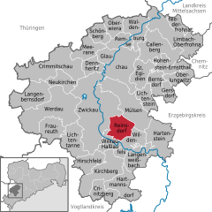 | |
 Reinsdorf  Reinsdorf | |
| Coordinates: 50°41′51″N 12°33′32″E / 50.69750°N 12.55889°E | |
| Country | Germany |
| State | Saxony |
| District | Zwickau |
| Subdivisions | 3 |
| Government | |
| • Mayor | Steffen Ludwig |
| Area | |
| • Total | 21.17 km2 (8.17 sq mi) |
| Highest elevation | 425 m (1,394 ft) |
| Lowest elevation | 296 m (971 ft) |
| Population (2022-12-31)[1] | |
| • Total | 7,282 |
| • Density | 340/km2 (890/sq mi) |
| Time zone | UTC+01:00 (CET) |
| • Summer (DST) | UTC+02:00 (CEST) |
| Postal codes | 08141 |
| Dialling codes | 0375 |
| Vehicle registration | Z |
| Website | www.reinsdorf.de |
Reinsdorf is a municipality in the district Zwickau, in Saxony, Germany.
References
- ^ "Einwohnerzahlen nach Gemeinden als Excel-Arbeitsmappe" (XLS) (in German). Statistisches Landesamt des Freistaates Sachsen. 2024.
| International | |
|---|---|
| National | |
| Geographic | |
This Zwickau location article is a stub. You can help Wikipedia by expanding it. |