River Rother, East Sussex
Appearance
51°02′46″N 0°13′08″E / 51.046°N 0.219°E
| River Rother, East Sussex | |
|---|---|
 | |
| Physical characteristics | |
| Mouth | Rye Bay, English Channel |
| Length | 35 miles (56km) |

- There is also a River Rother in West Sussex
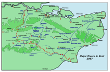
The River Rother (originally named “Limen”), at 35 miles (56 km), is a river flowing through both East Sussex and Kent, England. Its source is near Rotherfield (East Sussex), and its mouth is on Rye Bay, part of the English Channel.
The river’s section below Bodiam Castle is navigable; following that are the Rother Levels (where the sea once penetrated); the Isle of Oxney lies to the north; and near Rye the Walland Marsh is at its eastern bank. The river is navigable by canoes and kayaks as far up as Etchingham. The River Rother passes by or near the villages of Etchingham, Robertsbridge, Bodiam, Northiam, and Wittersham.
