
Ronneburg, Thuringia
Ronneburg | |
|---|---|
 Old town of Ronneburg | |
.png) Coat of arms | |
Location of Ronneburg within Greiz district 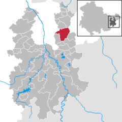 | |
| Country | Germany |
| State | Thuringia |
| District | Greiz |
| Subdivisions | 4 |
| Government | |
| • Mayor | Manfred Böhme (CDU) |
| Area | |
| • Total | 19.18 km2 (7.41 sq mi) |
| Elevation | 280 m (920 ft) |
| Population (2022-12-31)[1] | |
| • Total | 5,071 |
| • Density | 260/km2 (680/sq mi) |
| Time zone | UTC+01:00 (CET) |
| • Summer (DST) | UTC+02:00 (CEST) |
| Postal codes | 07580 |
| Dialling codes | 036602 |
| Vehicle registration | GRZ |
| Website | www.ronneburg.de |
Ronneburg is a town in the district of Greiz, in Thuringia, Germany. It is situated 7 km east of Gera.
History
Within the German Empire (1871-1918), Ronneburg was part of the Duchy of Saxe-Altenburg.
References
External links
| International | |
|---|---|
| National | |
| Geographic | |
This Greiz district location article is a stub. You can help Wikipedia by expanding it. |