
Saint-Jory
Saint-Jory | |
|---|---|
 | |
.svg) Coat of arms | |
Location of Saint-Jory  | |
| Country | France |
| Region | Occitania |
| Department | Haute-Garonne |
| Arrondissement | Toulouse |
| Canton | Fronton |
| Intercommunality | Hers et Garonne |
| Government | |
| • Mayor (2008–2014) | Henri Miguel |
| Area 1 | 19.1 km2 (7.4 sq mi) |
| Population (2008) | 5,026 |
| • Density | 260/km2 (680/sq mi) |
| Time zone | UTC+01:00 (CET) |
| • Summer (DST) | UTC+02:00 (CEST) |
| INSEE/Postal code | 31490 /31790 |
| Elevation | 105–125 m (344–410 ft) (avg. 119 m or 390 ft) |
| 1 French Land Register data, which excludes lakes, ponds, glaciers > 1 km2 (0.386 sq mi or 247 acres) and river estuaries. | |
Saint-Jory is a commune in the Haute-Garonne department in southwestern France.
Population
| Year | Pop. | ±% |
|---|---|---|
| 1962 | 1,528 | — |
| 1968 | 2,112 | +38.2% |
| 1975 | 2,533 | +19.9% |
| 1982 | 2,760 | +9.0% |
| 1990 | 3,244 | +17.5% |
| 1999 | 4,069 | +25.4% |
| 2008 | 5,026 | +23.5% |
Sights
The Château de Saint-Jory is a 16th-century castle which is listed as a historic site by the French Ministry of Culture.[1]
-
 Town hall
 -
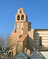
 Church
 -

-


See also
References
- ^ www.culture.gouv.fr, accessed 17 March 2008
Wikimedia Commons has media related to Saint-Jory.
This Haute-Garonne geographical article is a stub. You can help Wikipedia by expanding it. |