Sainte-Marie, Martinique
Sainte-Marie | |
|---|---|
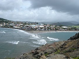
 A view of Sainte-Marie from the islet | |
 Location of the commune (in red) within Martinique | |
| Coordinates: 14°44′N 61°01′W / 14.73°N 61.02°W | |
| Country | France |
| Overseas region and department | Martinique |
| Arrondissement | La Trinité |
| Government | |
| • Mayor (2008–2014) | Nestor Bruno Azérot |
| Area 1 | 44.55 km2 (17.20 sq mi) |
| Population (2013) | 17,418 |
| • Density | 390/km2 (1,000/sq mi) |
| Time zone | UTC−04:00 (AST) |
| INSEE/Postal code | 97228 /97230 |
| Elevation | 0–574 m (0–1,883 ft) |
| 1 French Land Register data, which excludes lakes, ponds, glaciers > 1 km2 (0.386 sq mi or 247 acres) and river estuaries. | |
Sainte-Marie is a town and the fifth-largest commune in the French overseas department of Martinique. It is located on the northeast (Atlantic Ocean) side of the island of Martinique.
See also
References
External links
Wikimedia Commons has media related to Sainte-Marie, Martinique.


