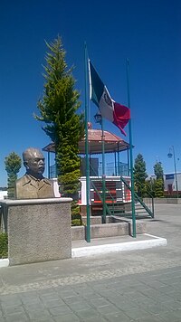
Sanctórum de Lázaro Cárdenas
Appearance
Sanctorum de Lázaro Cárdenas | |
|---|---|
 Sanctórum | |
 | |
| Country | |
| State | Tlaxcala |
| Time zone | UTC-6 (Central Standard Time) |
| • Summer (DST) | UTC-5 (Central Daylight Time) |
Sanctorum de Lázaro Cárdenas is a municipality in Tlaxcala in south-eastern Mexico.[1]
References
- ^ "-". Enciclopedia de los Municipios de México. Instituto Nacional para el Federalismo y el Desarrollo Municipal. Retrieved January 4, 2009.

