Sangro
Appearance
| Sangro | |
|---|---|
 | |
 | |
| Physical characteristics | |
| Mouth | Adriatic |
| Length | 122 km |
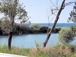
The Sangro is a river in eastern central Italy, known ancient times as Sagrus.

It rises in the Abruzzo National Park in the Apennine Mountains, before flowing northeast through Castel di Sangro, Ateleta, Quadri, and Villa Santa Maria, before flowing into the Lago di Sangro. From there it flows northeast and joins the Aventino River, and thence into the Adriatic Sea south of Punta Cavelluccio.
